Folded Gold: The Maps Collectors Are Paying Big For
Old maps aren’t just beautiful—they’re rare windows into the way people once saw the world. From hand-drawn colonial maps to early depictions of the American West, collectors now pay thousands for pieces that were once folded up in saddlebags or hung in classrooms. Whether antique or mid-century modern, some old maps have skyrocketed in value due to age, rarity, accuracy, and condition.
Here are 25 maps, ranked from least to most valuable, that are worth a closer look.
Rand McNally Road Map (1953)
Estimated value: $30
Once handed out at gas stations for free, these colorful road maps of the US now charm collectors with their retro artwork and sponsor logos. Maps still in folded condition with no tears—especially from defunct oil companies—can fetch surprising amounts online.
 Ramblin! - Rand McNally 2024 100th Anniversary Atlas Review, Steve's Wanderlust
National Geographic World Map Poster (1965)
Estimated value: $40
If you had this on your childhood bedroom wall, you're not alone. These large-format maps are appreciated for their educational design and Cold War-era borders. Uncreased versions still in mailing tubes are the most desirable.
 UN Geospatial, Wikimedia Commons
US Forest Service Recreation Maps (1930s)
Estimated value: $50
Printed by the government, these detailed hiking and forest maps are popular among outdoorsy collectors. The ones showing now-defunct trails or cabins are particularly collectible. The better the condition, the higher the price.
 U.S. Forest Service, Wikimedia Commons
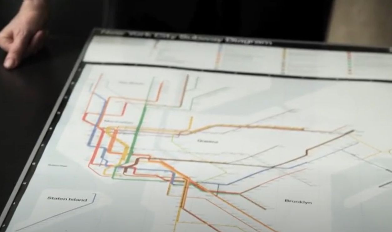
New York City Transit Map (1972)
Estimated value: $60
This now-retired psychedelic design by Massimo Vignelli was controversial for its stylized layout. Today, it’s a cult classic among design fans and NYC history buffs. Originals in frame-worthy condition are a must-have.
 Debbie Millman interviews Massimo Vignelli, directed by Hillman Curtis. debbie millman
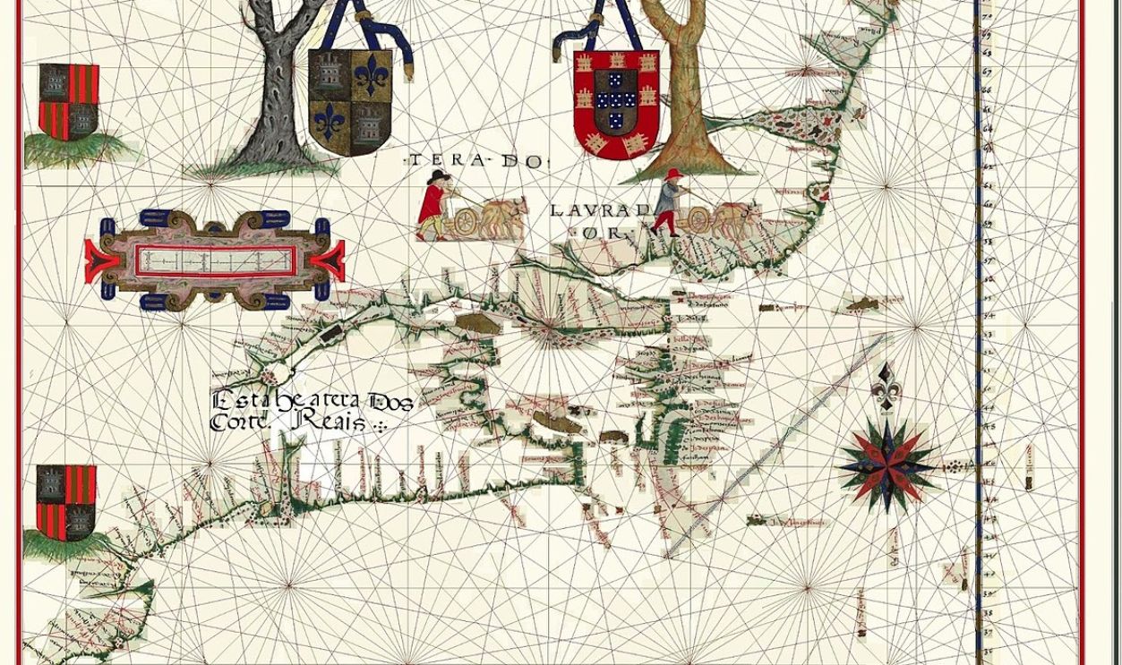
Gaspar Corte-Real Commemorative Map (1950s Reprint)
Estimated value: $75
These mid-century decorative reprints of 16th-century Portuguese explorer maps became popular with history teachers and libraries. While not original, well-preserved versions are valued for their artistry and framing appeal.
 Fernão Vaz Dourado, Wikimedia Commons
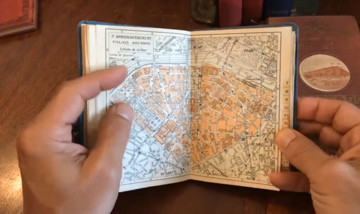
Baedeker’s Folding Travel Map of Paris (1890)
Estimated value: $100
Tucked inside old red Baedeker guidebooks, these maps were prized by wealthy European travelers. When separated and framed, they appeal to collectors of both Parisian history and antique travel gear.
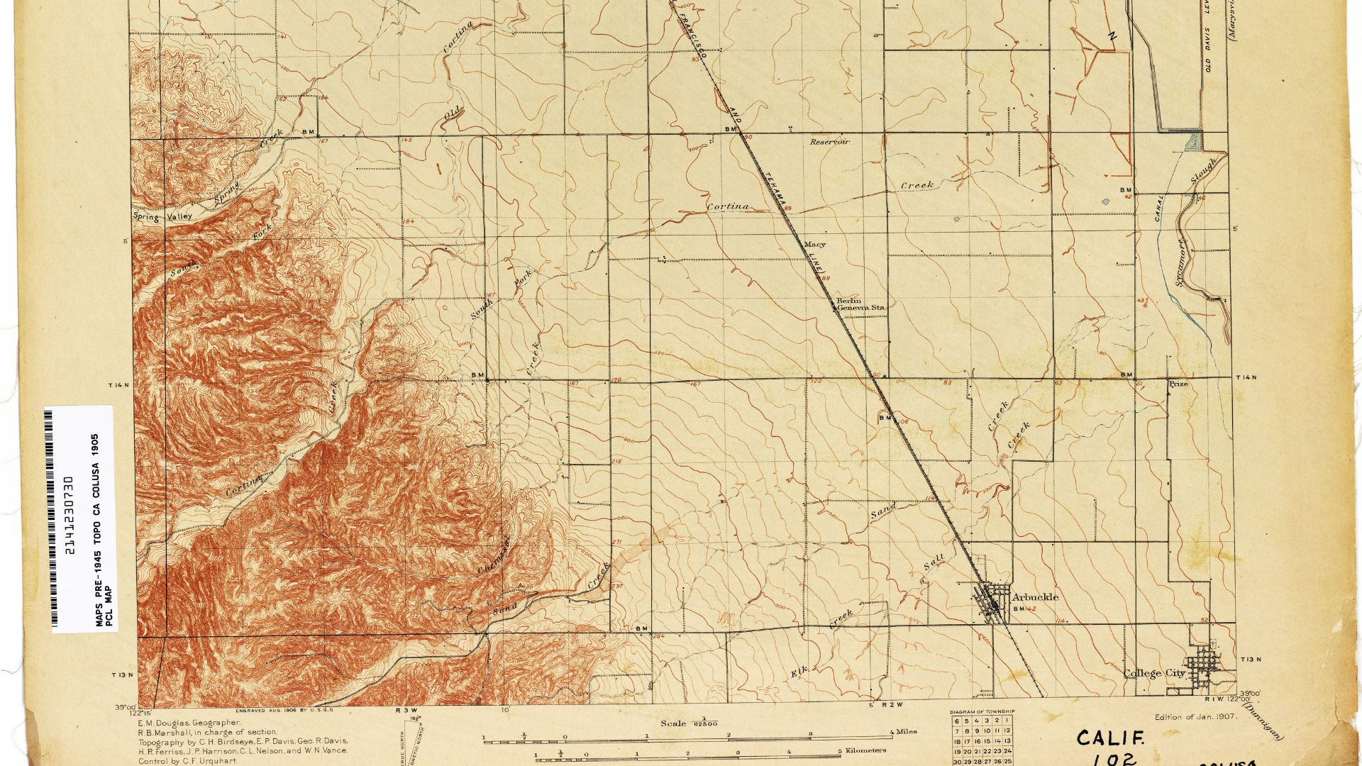
US Geological Survey Topo Map (1895)
Estimated value: $125
These detailed topographic maps of specific US regions are great for local collectors or historians. The older and more obscure the region, the more desirable the map becomes—especially if it shows now-vanished settlements.
 United States Geological Survey, Wikimedia Commons
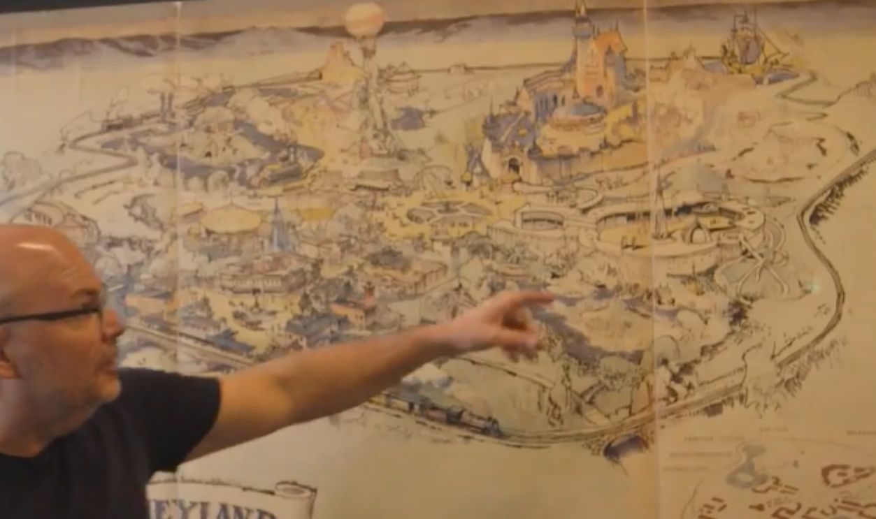
Map of Disneyland (Opening Year - 1955)
Estimated value: $150
Souvenir maps handed out at Disneyland’s opening day are rare finds. The whimsical illustrations and vintage park layout attract both Disney collectors and mid-century pop culture enthusiasts. Pristine copies are getting harder to find.
 Walt's First Disneyland Map, CNN
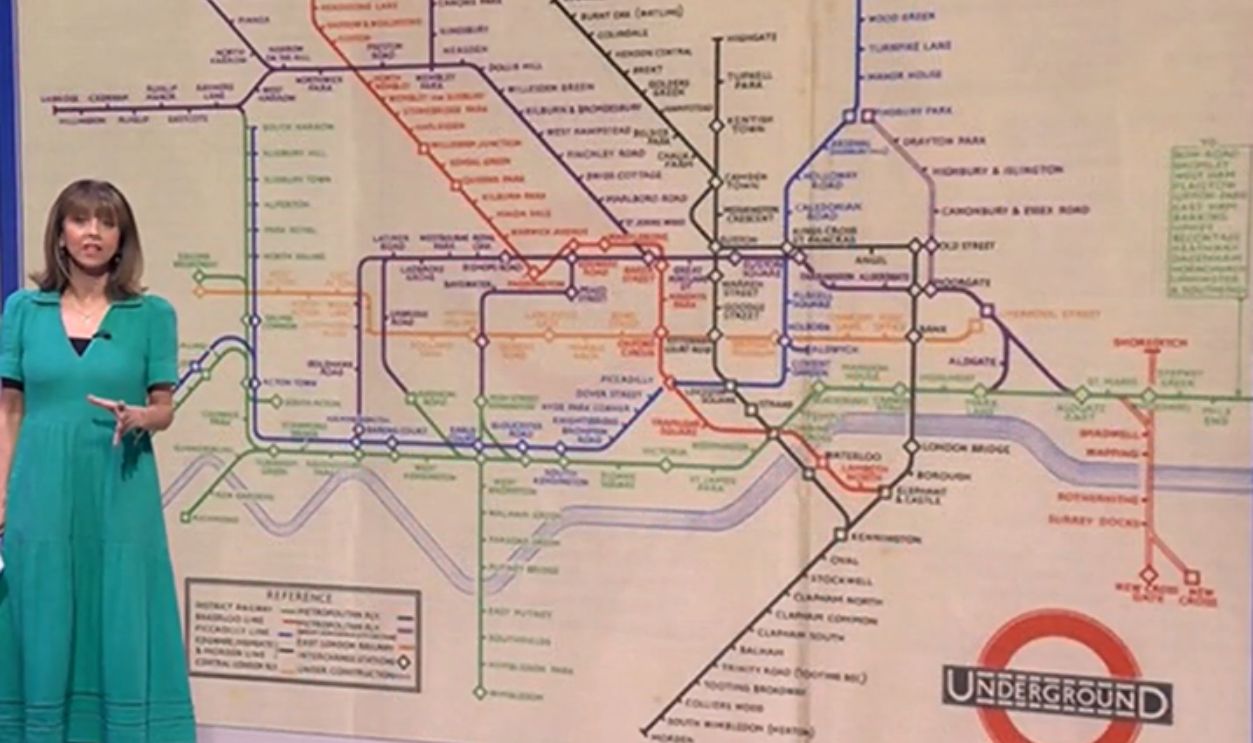
London Underground Map by Harry Beck (1933 Original or Early Print)
Estimated value: $175
Harry Beck revolutionized transit map design with his simplified diagram of the Tube. Early versions are design icons now displayed in museums. Paper originals in good shape are highly sought after.
 Harry Beck's Tube map from 1933 and its iconic design and more (UK) 18/Sep/2024, Mark 1333
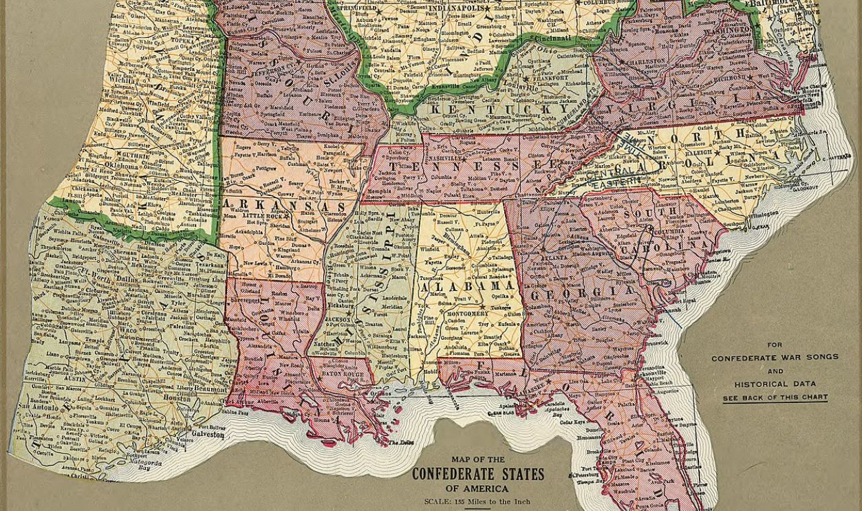
Confederate States Map (Reproduction or Rare Print)
Estimated value: $200
Maps produced during or shortly after the Civil War showing Confederate states and battle locations are sought after for their historical value. Even well-made 19th-century reproductions can command decent prices depending on condition.
 Lee, Fitzhugh, Wikimedia Commons
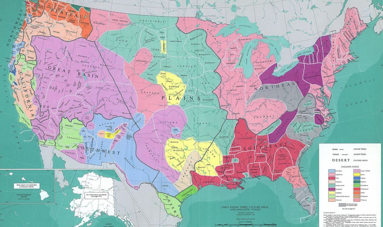
Native American Tribal Lands Map (1940s US Govt. Print)
Estimated value: $225
These educational maps showing tribal territories pre- and post-relocation are often found in schools and universities. Early editions, especially with detailed annotations, are valued for their historical and social importance.
 William C. Sturtevant,, Wikimedia Commons
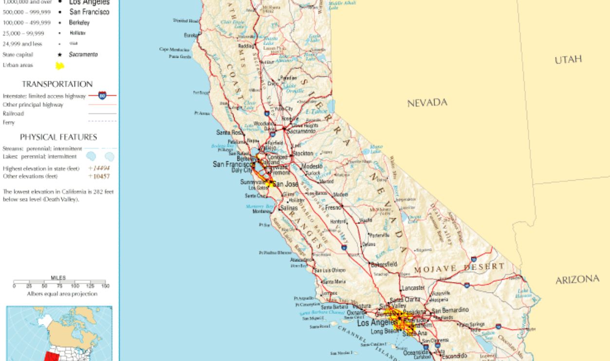
Pictorial Map of California (1930s)
Estimated value: $250
These colorful, cartoonish maps were popular as souvenirs and travel promotions. Featuring grapes, Hollywood stars, and Spanish missions, they’re beloved by vintage California lovers. The rarer the region depicted, the higher the value.
 National Atlas of the United States, Wikimedia Commons
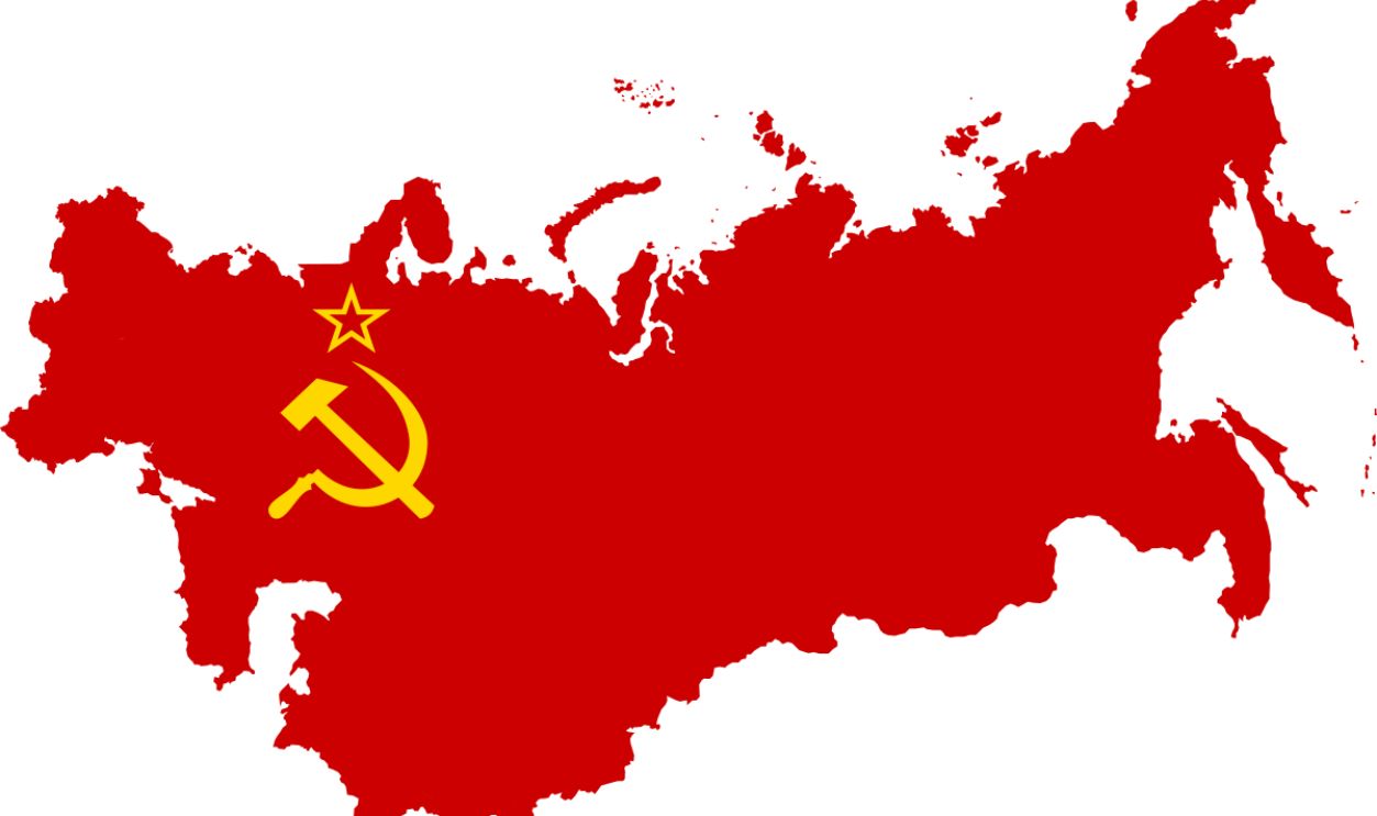
Soviet World Map (Cold War Era - Cyrillic)
Estimated value: $275
Produced in the USSR for schools and government offices, these maps reflected the political lens of the time. Rare surviving examples in Cyrillic script are fascinating for Cold War collectors and political history fans.
 Dmitry-5-Averin, Wikimedia Commons
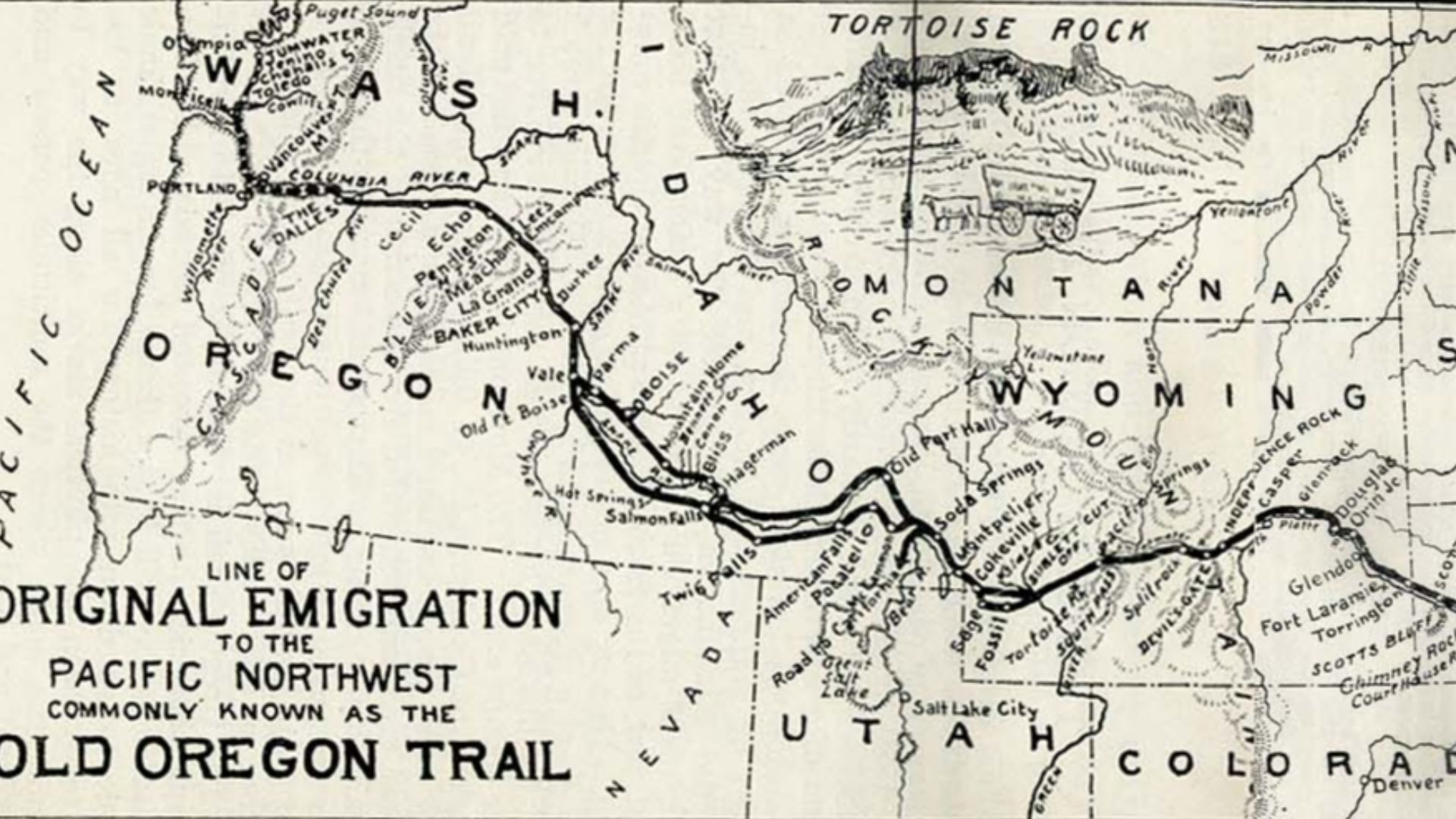
1840s Map of the Oregon Trail
Estimated value: $300
This hand-drawn style map showing the path westward became an icon of American pioneer spirit. Any original prints from guidebooks or settlers' journals now sell well at Western memorabilia auctions.
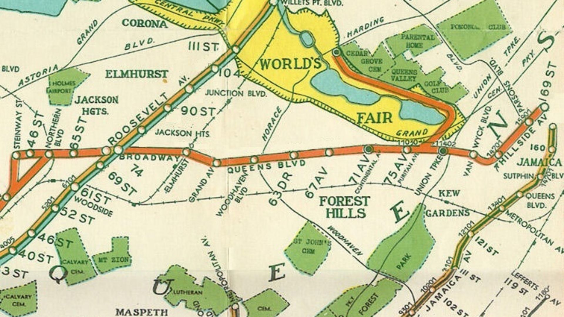
1939 New York World’s Fair Map
Estimated value: $350
This futuristic event was heavily documented, and its souvenir maps are prized for their art deco style. If the map includes pavilions and attractions that were never built, it's even more valuable.
 Published by George J Nostrand in 1939, Wikimedia Commons
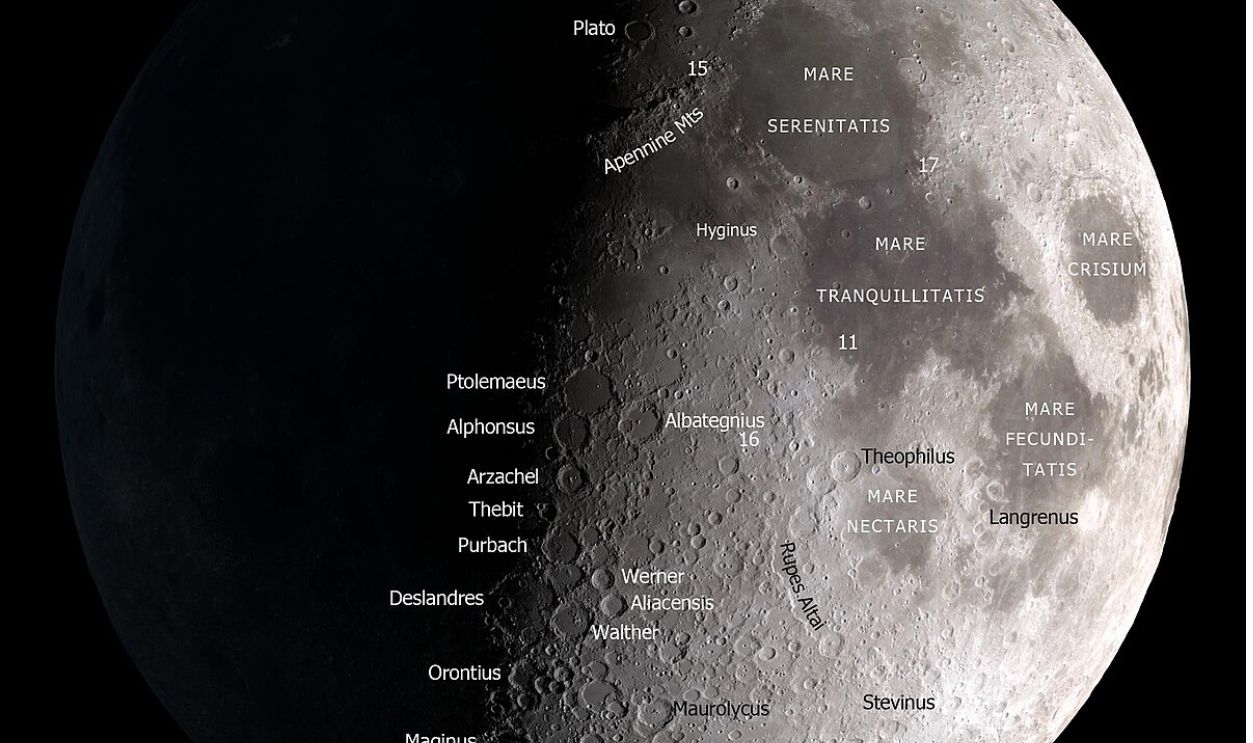
Map of the Moon (1950s NASA/Early Space Race)
Estimated value: $400
Early NASA lunar maps were printed before any landing had occurred. These documents show humanity’s early guesses and missions-to-be. They're a huge hit with space collectors, especially in original NASA envelopes.
 NASA Goddard Space Flight Center, Wikimedia Commons
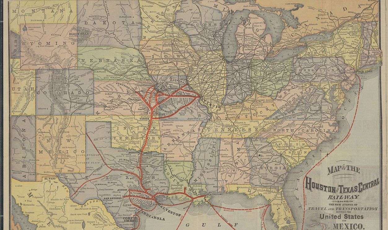
Early Rand McNally Railroad Map (1880s)
Estimated value: $500
These intricately detailed maps helped travelers and shippers navigate the expanding rail network. Because so few survive in good condition, they’re hot items in both railway and antique map collecting circles.
 University of Texas at Arlington, Wikimedia Commons
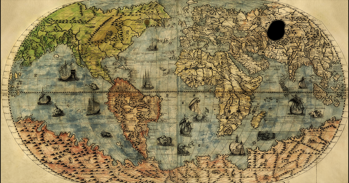
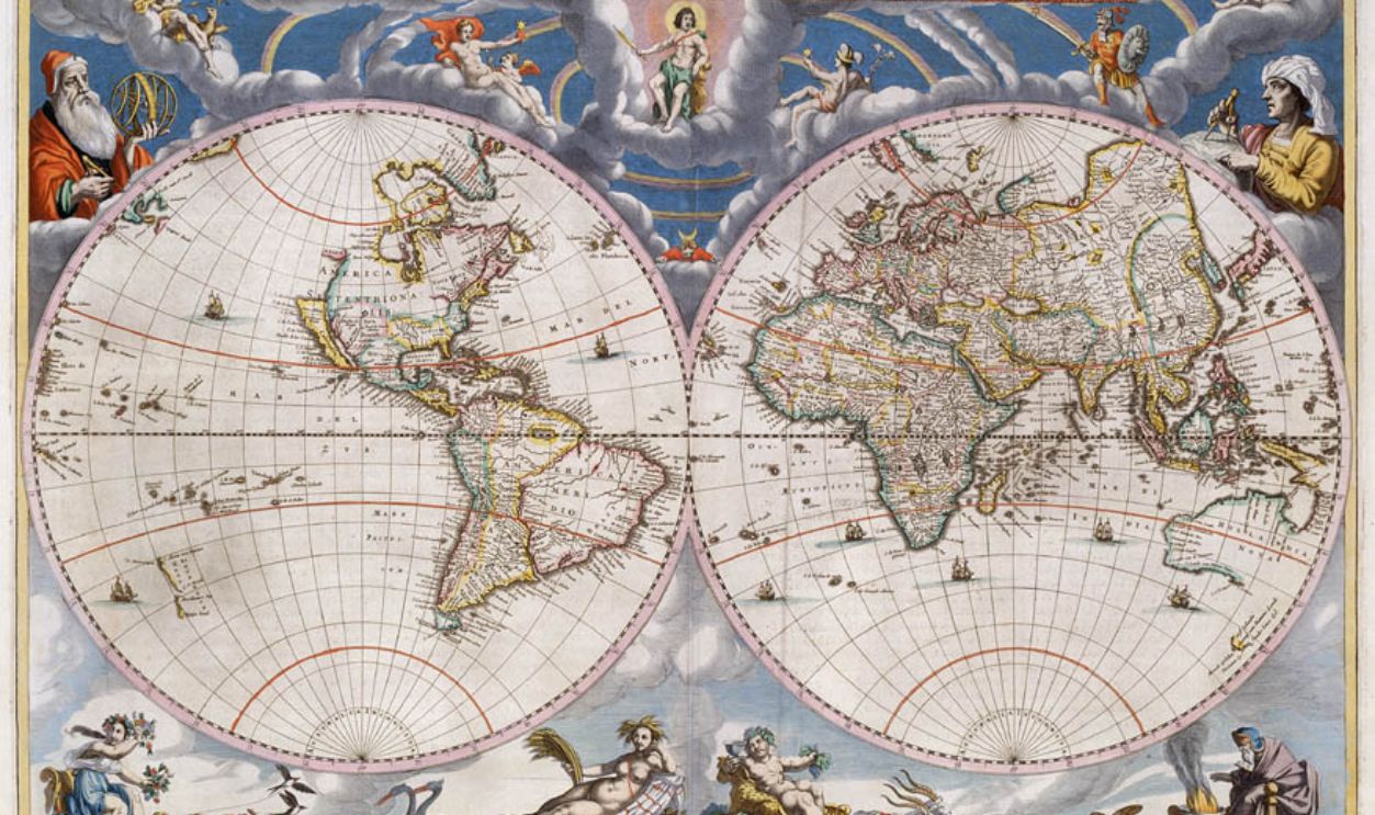
Blaeu’s Map of the World (17th Century Reproduction)
Estimated value: $600
Originals fetch tens of thousands, but even high-quality early reprints of this ornate Dutch masterpiece can be worth hundreds. The artwork, mythical sea monsters, and elaborate cartouches make it one of the most admired maps in history.
 Johannes Blaeu, Wikimedia Commons
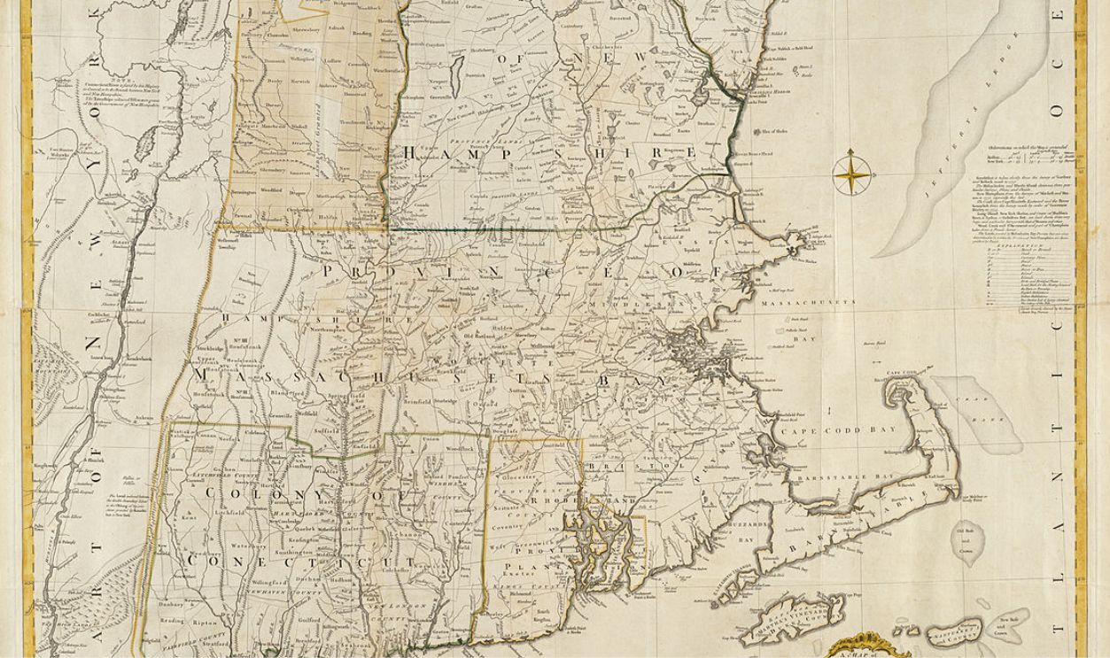
Colonial Map of New England (1700s)
Estimated value: $700
These maps often contain inaccuracies that reveal the mapmaker’s limited understanding at the time. Their age and imperfections are what make them valuable—especially if hand-colored and bearing marks from the original owner.
 http://maps.bpl.org, Wikimedia Commons
Map of Africa by Abraham Ortelius (Reprint or Fragment)
Estimated value: $800
Ortelius was a pioneer of atlas-making. While original 16th-century prints sell for thousands, verified fragments or early reprints from the 17th–18th centuries can still bring in serious money, especially in fine condition.
 Abraham Ortelius, Wikimedia Commons
1776 American Revolutionary War Map
Estimated value: $1,200
Maps produced during the year of independence—especially British ones detailing colonies—are very rare and incredibly desirable. Maps with notations or provenance to officers or political figures climb in value fast.
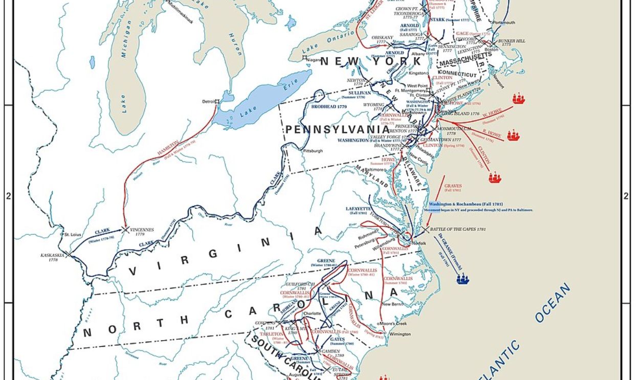 United States Military Academy - West Point, Wikimedia Commons
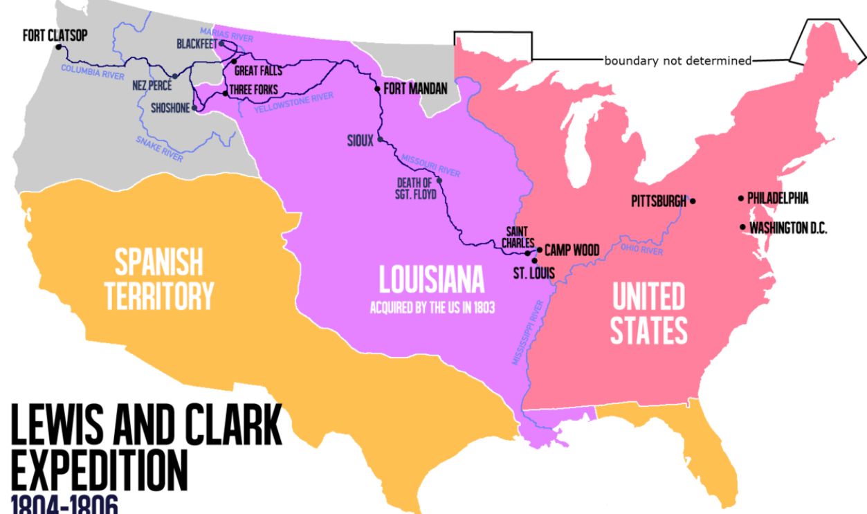
Lewis & Clark Expedition Map (1800s Edition)
Estimated value: $2,000
Early maps documenting the famous westward expedition are central to American exploration history. Original lithographs or early printed editions command high prices, especially if tied to the official government reports.
 Victor van Werkhooven, Wikimedia Commons
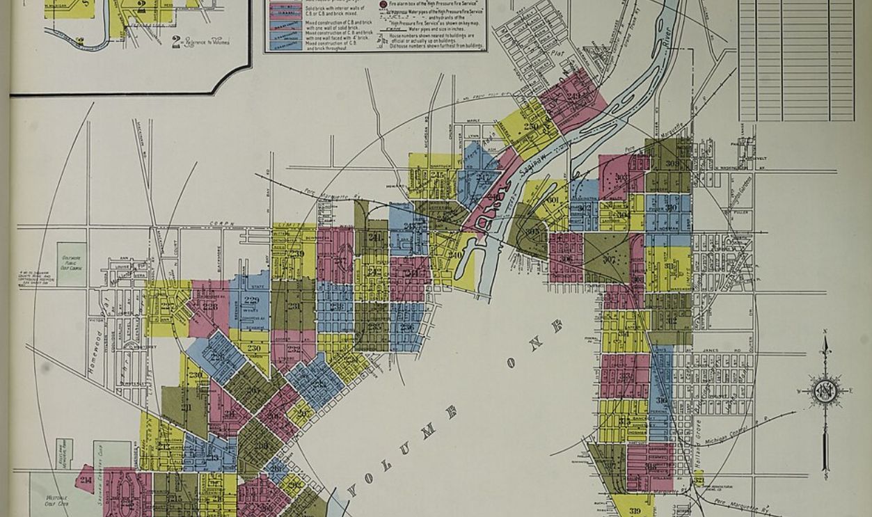
Sanborn Fire Insurance Map (Original Bound Volume)
Estimated value: $2,500
These detailed maps of urban areas were used to assess fire risk. Bound volumes from the 19th century, especially of large or now-altered cities, are rare and often used in historical preservation.
 Victor van Werkhooven, Wikimedia Commons
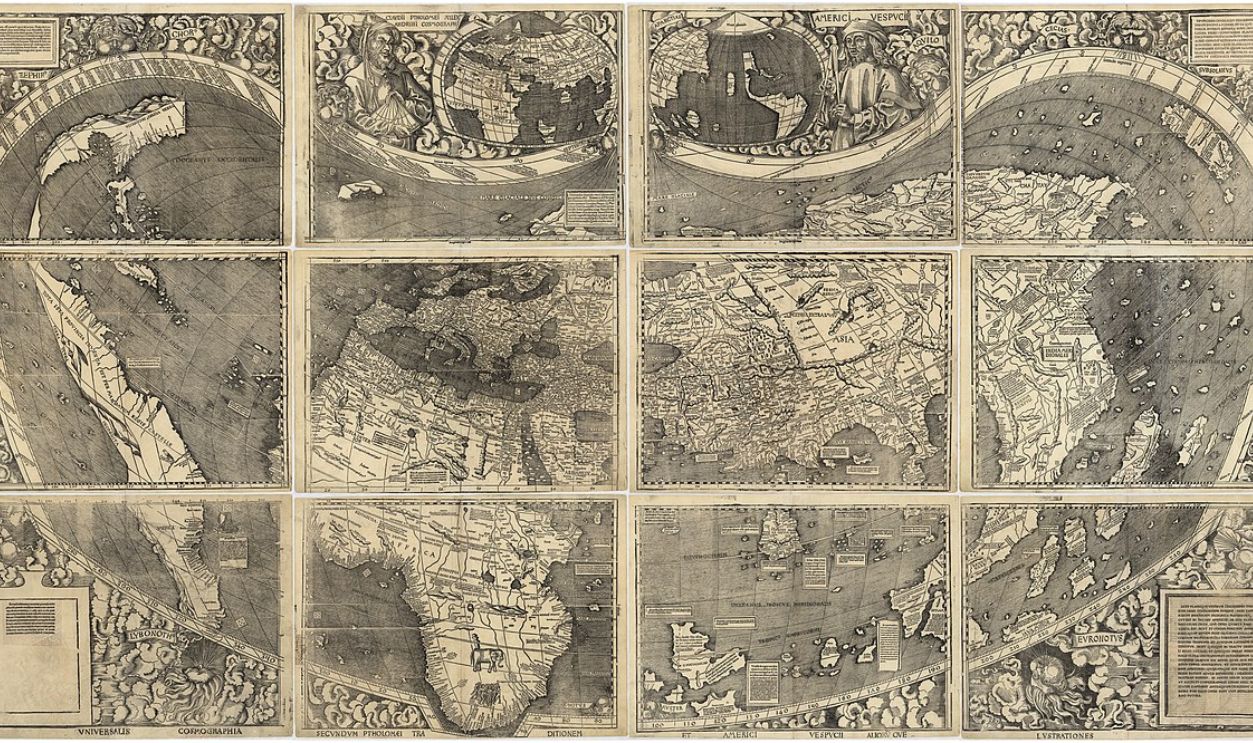
First Map to Label “America” (1507 Reproduction)
Estimated value: $3,000
The Waldseemüller map is the first known map to label the continent “America.” Originals are museum-only, but even early reprints or fragments of commemorative editions from the 1800s or 1900s can sell for thousands due to their historical weight.
 Martin Waldseemüller, Wikimedia Commons
You May Also Like:
Highest Grossing Video Games Of All Time
22 Rare Vinyl Records Worth Big Money
37 Rare Movie DVDs Worth Big Money
Sources: 1, 2, 3, 4, 5


